March 26, 2026
For years, generating map tiles, GIS visualizations, and fast raster graphics in Ruby has been a painful experience. ImageMagick derivatives were slow. External services added latency and complexity. The old ruby-gd binding languished unmaintained. Then ruby-libgd arrived – a modern, actively maintained binding to the GD library. But ruby-libgd alone addressed only part of the problem: it provided fast rendering, but lacked GIS-aware abstractions. Until recently, Ruby developers could render images efficiently, but geographic visualization required custom glue code.
Enter libgd-gis—a native rendering engine built specifically for Ruby’s geospatial and graphics needs. More importantly, it’s catalyzing a shift in how the Ruby community approaches visualization and spatial data.
The Problem: Ruby’s Graphics Bottleneck
Ruby’s strength lies in developer happiness and rapid iteration. But when you need to generate images – especially thousands of map tiles, heatmaps, or GIS overlays—that strength evaporates. Here’s why:
ImageMagick/RMagick/MiniMagick: These are powerful but bloated for simple rendering tasks. They shell out to external processes or wrangle heavyweight image libraries, creating bottlenecks in server-side image generation pipelines. For tile servers or real-time visualization APIs, this overhead becomes prohibitive.
ruby-gd: The original GD bindings for Ruby were convenient but haven’t been actively maintained. Modern GIS workflows demand more: layer composition, coordinate system transformations, efficient memory handling.
External services: Relying on Google Maps API, Mapbox, or self-hosted tile servers adds latency, cost, and infrastructure complexity when you just want to render a quick visualization from raw data.
At RubyConf 2025, this gap was acknowledged directly: Ruby needed a fast, maintainable solution for in-memory image rendering that understood geographic data natively.
libgd-gis: A Purpose-Built Solution
libgd-gis arrives as a native raster engine for Ruby, purposefully designed for GIS and map rendering. It eliminates the middleman—no ImageMagick, no external processes, no network round-trips.
What makes it different:
- Fast, in-memory rendering: Generates images directly in process without shelling out or spawning workers
- GIS-aware: Understands coordinate systems, bounding boxes, and geographic primitives natively
- Lightweight: Focused scope-it does rendering well, not everything
- Modern maintenance: Built for contemporary Ruby workflows and actively developed
The technical approach is elegant: libgd-gis stabilized its core rendering API recently, consolidating static GIS rendering, layered composition, and post-render image manipulation into a documented, stable surface. This means it’s not a moving target—developers can build on it confidently.
Geodetic: A Real-World Example of the Ecosystem in Action
The beauty of libgd-gis becomes apparent when you see it integrated into existing projects. Geodetic, a mature Ruby gem for geodetic coordinate conversions and geographic calculations, recently adopted libgd-gis as a pluggable rendering adapter.
Before libgd-gis, Geodetic could handle geographic data beautifully—precise conversions between 18 coordinate systems, distance calculations, polygon operations—but visualizing that data meant reaching for external tools. Now:
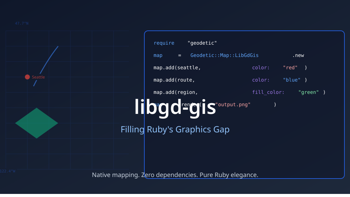
require "geodetic"require "libgd-gis"# Define your geographic areanw = Geodetic::Point.new(latitude: 47.7, longitude: -122.4)se = Geodetic::Point.new(latitude: 47.5, longitude: -122.2)bbox = Geodetic::Areas::BoundingBox.new(nw: nw, se: se)# Create a map using the libgd-gis adaptermap = Geodetic::Map::LibGdGis.new( bbox: bbox, width: 800, height: 600)# Add geometry with stylingseattle = Geodetic::Point.new(latitude: 47.6, longitude: -122.3)route = Geodetic::LineString.new([point1, point2, point3])region = Geodetic::Polygon.new([...])map.add(seattle, color: "red", label: "Seattle")map.add(route, color: "blue", width: 3)map.add(region, fill_color: "green", opacity: 0.5)# Render directly to PNGmap.render("seattle_map.png")
This integration exemplifies good design: Geodetic’s core remains untouched, but new capabilities arrive through a pluggable adapter pattern. Other backends (web maps, 3D visualizations) can follow the same pattern without changing Geodetic itself.
The Ecosystem Implication
What’s happening here is significant. libgd-gis isn’t just another library—it’s enabling a ecosystem shift:
- Existing gems get visualization superpower: Geodetic, Geokit, and other geospatial libraries can now add rendering without implementing it themselves. They plug in libgd-gis through adapters.
- New use cases become practical: Real-time map tile generation, server-side GIS dashboards, and dynamic spatial visualizations are now viable in pure Ruby without infrastructure complexity.
- Performance-conscious applications: Teams building high-volume map rendering services (real estate platforms, logistics dashboards, geospatial analytics) have a native option that doesn’t require RMagick or external tile services.
- Community consolidation: Instead of fragmenting into multiple rendering solutions, the Ruby community is coalescing around libgd-gis as the standard for GIS visualization.
What’s Next for libgd-gis
The recent API stabilization is a signal: libgd-gis is moving from “interesting experiment” to “production infrastructure.” What’s on the horizon:
- More adapter integrations: As word spreads, expect more gems (Leaflet bindings, Rails helpers, real estate libraries) to adopt libgd-gis adapters
- Performance optimizations: Already fast, but native compilation and batching improvements are likely
- Expanded styling: More expressive symbology and layer blending modes as use cases demand them
- WebAssembly consideration: Long-term, WASM could bring libgd-gis to the browser
Why This Matters for Ruby
This isn’t just about maps. libgd-gis represents a broader trend: Ruby solving its own problems with purpose-built, community-driven libraries rather than shoehorning external tools.
For too long, Ruby developers reaching for “graphics” or “maps” got forced into slow, complicated solutions. libgd-gis and its growing ecosystem say: you can do this elegantly and efficiently in Ruby.
The Geodetic integration is just the beginning. As more developers discover that rendering geographic data is now pleasant in Ruby, we’ll see more ambitious projects. Heatmaps, spatial analysis dashboards, real-time tile servers—all of these shift from “we’ll need a side service” to “we can do this in Rails.”
That’s ecosystem progress.
Getting Started
If you’re working with geographic data in Ruby:
gem 'geodetic'gem 'libgd-gis'
The Geodetic documentation includes libgd-gis examples. Experiment. Build. Share what you create. The ecosystem grows when developers integrate these tools into real projects.
Ruby’s graphics gap is narrowing. And that’s a win for the entire community.
Have you integrated libgd-gis into your project? Share your experience on Ruby-Talk or Twitter—the ecosystem thrives on real-world stories.