April 12, 2026
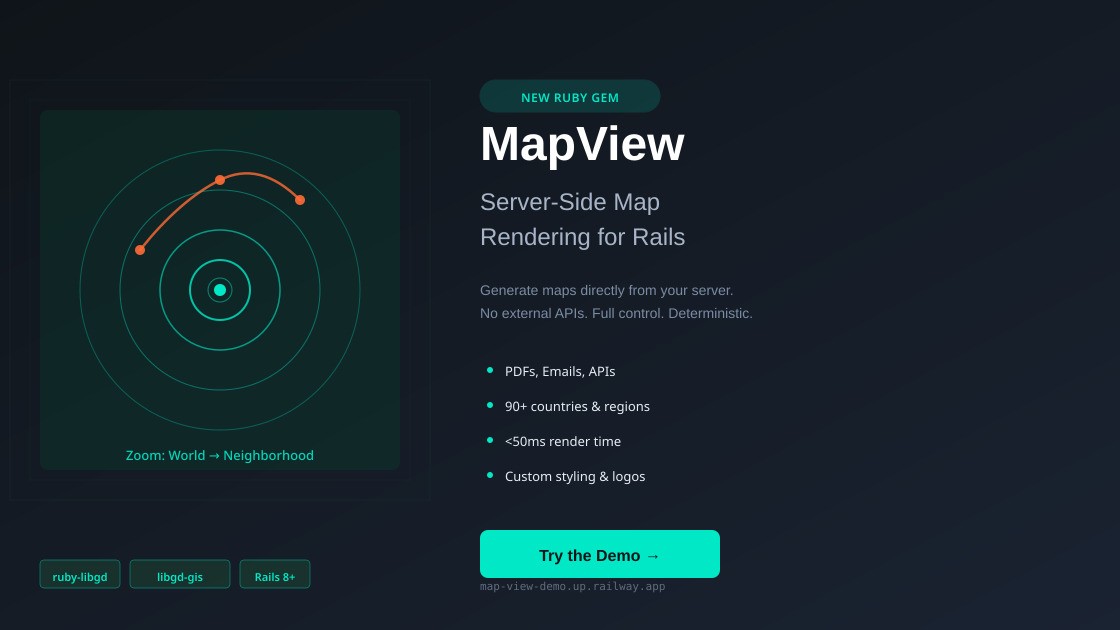
After an extensive development journey, MapView has arrived: a powerful API for generating map images directly from your Ruby server.
What is MapView?
MapView is a Ruby gem that enables you to render maps, routes, points, and polygons with zoom levels ranging from a global world view down to neighborhood-specific details. Everything is processed server-side, without JavaScript dependencies or expensive external API calls.
Built on ruby-libgd and libgd-gis, a robust architecture that delivers:
- ✅ Deterministic rendering (predictable results)
- ✅ Multiple map styles (OSM, Carto, Mapnik, etc.)
- ✅ Configurable resolutions (up to 4K)
- ✅ Full customization: legends, logos, watermarks
- ✅ GeoJSON support, routes, real-time alerts
Use Cases
Embedded in PDFs and Emails:
map = MapView.render( bbox: "argentina", basemap: :osm, geojson: routes_data, width: 800, height: 600)# Attach directly to PDFs or emails
Custom REST APIs: Create endpoints that generate maps on-demand, giving your users complete control over geographic data visualization.
Real-Time Dashboards: Update route visualizations, alerts, and points of interest as data arrives from your endpoints.
Logistics & Delivery Tracking: Generate route maps with multiple stops, travel times, and status indicators for customer communications.
Report Generation: Automate the creation of geographic reports with embedded maps, perfect for stakeholder presentations.
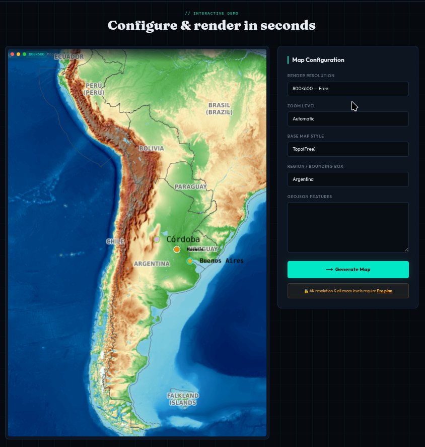
Interactive Demo
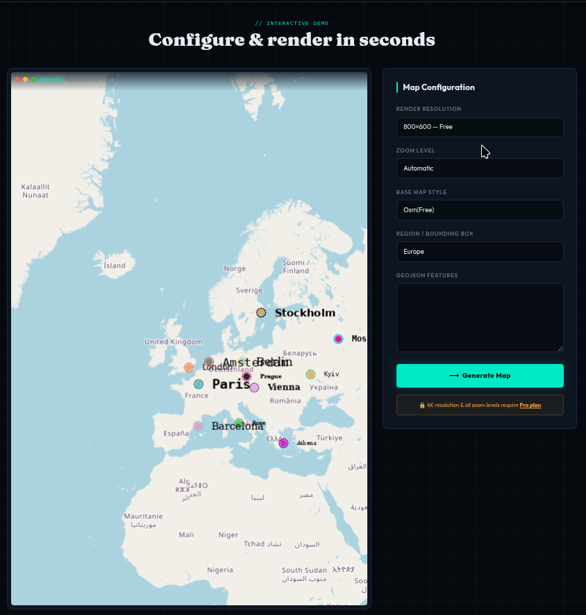
Try MapView without installation:
🔗 https://map-view-demo.up.railway.app/
You can:
- Switch between 90+ countries and regions
- Upload custom GeoJSON data
- Experiment with different map styles
- View rendering in real-time
Sample GeoJSON to test:
{ "type": "FeatureCollection", "features": [ { "type": "Feature", "geometry": { "type": "Point", "coordinates": [-58.3816, -34.6037] }, "properties": { "name": "Buenos Aires", "description": "Capital of Argentina" } }, { "type": "Feature", "geometry": { "type": "LineString", "coordinates": [[-58.3816, -34.6037], [-64.1833, -31.4167]] }, "properties": { "name": "Route BA to Córdoba" } } ]}
Licensing Options
STARTER (Free)
- 5 renders/day
- Maximum resolution: 800×600px
- 2 basemaps (OSM, Topo)
- Community support
PROFESSIONAL ($99/month)
- 50 renders/day
- 4K resolution support
- 10+ basemaps available
- REST API access
- Commercial license
- Priority support
ENTERPRISE (Custom)
- Unlimited renders
- On-premise deployment option
- SLA guarantee
- Dedicated technical support
- Team training included
- Custom styling and integration
Getting Started
To integrate MapView into your Rails project:
👉 Get in touch: https://map-view-demo.up.railway.app/contact
We’ll respond within 24 hours with:
- Complete documentation
- Integration roadmap
- Team training options
- Personalized licensing
Technical Stack
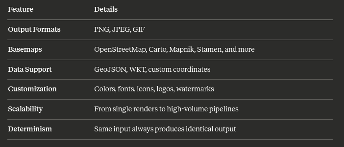
MapView is built on proven technologies:
- ruby-libgd: High-performance Ruby bindings for libgd
- libgd-gis: GIS raster rendering engine
- Rails integration: Works seamlessly with Rails 6+
- Performance: <50ms average render time
- Uptime: 99.9% availability
Features at a Glance
Why Server-Side Rendering?
- Privacy: Geographic data stays on your servers
- Control: No external dependencies or rate limits
- Cost: No per-request API charges
- Reliability: Deterministic results for reproducible reports
- Integration: Seamlessly embed maps in PDFs, emails, and documents
- Performance: Sub-50ms rendering on standard hardware
Learn More
MapView: Full control over map rendering, directly in your Rails app. 🗺️